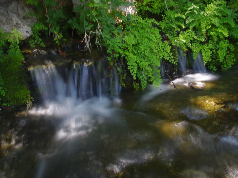
 Ferns grow in cool places, where springs flow from the canyon walls.Photo by Stephan Lorenz
 The region lies in a transitional zone where the Hill Country to the east gradesinto the Chihuahuan Desert to the west.Photo by Stephan Lorenz
 The Devils River is popular with canoeists and kayakers.Photo by Stephan Lorenz
 There are many reminders within the park that this used to be a working ranch.Many of the rugged canyons protect Native American archeological sites.Photo by Stephan Lorenz
 Springs pour millions of gallons of the purest water into the river year-round.Photo by Stephan Lorenz
 The Devils River forms an oasis in this otherwise arid country.Photo by Stephan Lorenz
 Within the park, about one mile of river is accessible.Photo by Stephan Lorenz
 Over 20 miles along winding gravel will bring visitors to the heart of thissparsely settled country.Photo by Stephan Lorenz
 Today the park is surrounded by private land.Photo by Stephan Lorenz
 Loma Alta is the closest service station, but offers just the basics.Photo by Stephan Lorenz
 The vegetation is surprisingly lush within the floodplain of Dolan Creek.Photo by Stephan Lorenz
 It’s a long haul west from Houston to reach the remote Devils River StateNatural Area.Photo by Stephan Lorenz
 The few trails in the state natural area are open to hiking and mountain biking.Photo by Stephan Lorenz

School's out, summer has arrived, and with it comes a bounty of weekend getaway inspiration for Houston travelers.
Travelers on the hunt for the ultimate summer adventure outside of H-Town can head down Austin for a Father's Day barbecue showdown, leap to the coast for a restaurant takeover at a Galveston hotel, or say hello to Maisie the Highland cow at a new farm retreat in Jewett, Texas.
Here are CultureMap's top picks for a June vacation around Texas.
Around Texas
As summer arrives and gas prices remain high, fuel-conscious Texas travelers can book their next road trip with transportation startup Shutto, which recently launched new routes connecting major cities like Dallas, Austin, Houston Galleria, and The Woodlands. Each route includes a pit stop at Buc-ee's — a quintessential road trip moment — and travelers can also book private, customizable trips beyond the scheduled routes. Fares start at $87 per person to Austin and $97 per person to Houston, and trips can be booked online.
Central Texas and the Hill Country
The historic Faust Hotel in New Braunfels has finally completed its thoughtful restoration and reopened its doors for Hill Country travelers. All 45 guest rooms and 15 deluxe suites have been updated with king beds, custom vanities, 55-inch streaming televisions, retro Frigidaire mini-fridges, and much more. The hotel's new signature restaurant, Wilhelm & Werner, mixes Texas and European culinary influences with dishes like an "apple strudel" of foie gras and pork, saffron tagliatelle with Gulf shrimp, and poulet rôti with a savory bread pudding. Nightly rates at the Faust Hotel begin at $215 in June.
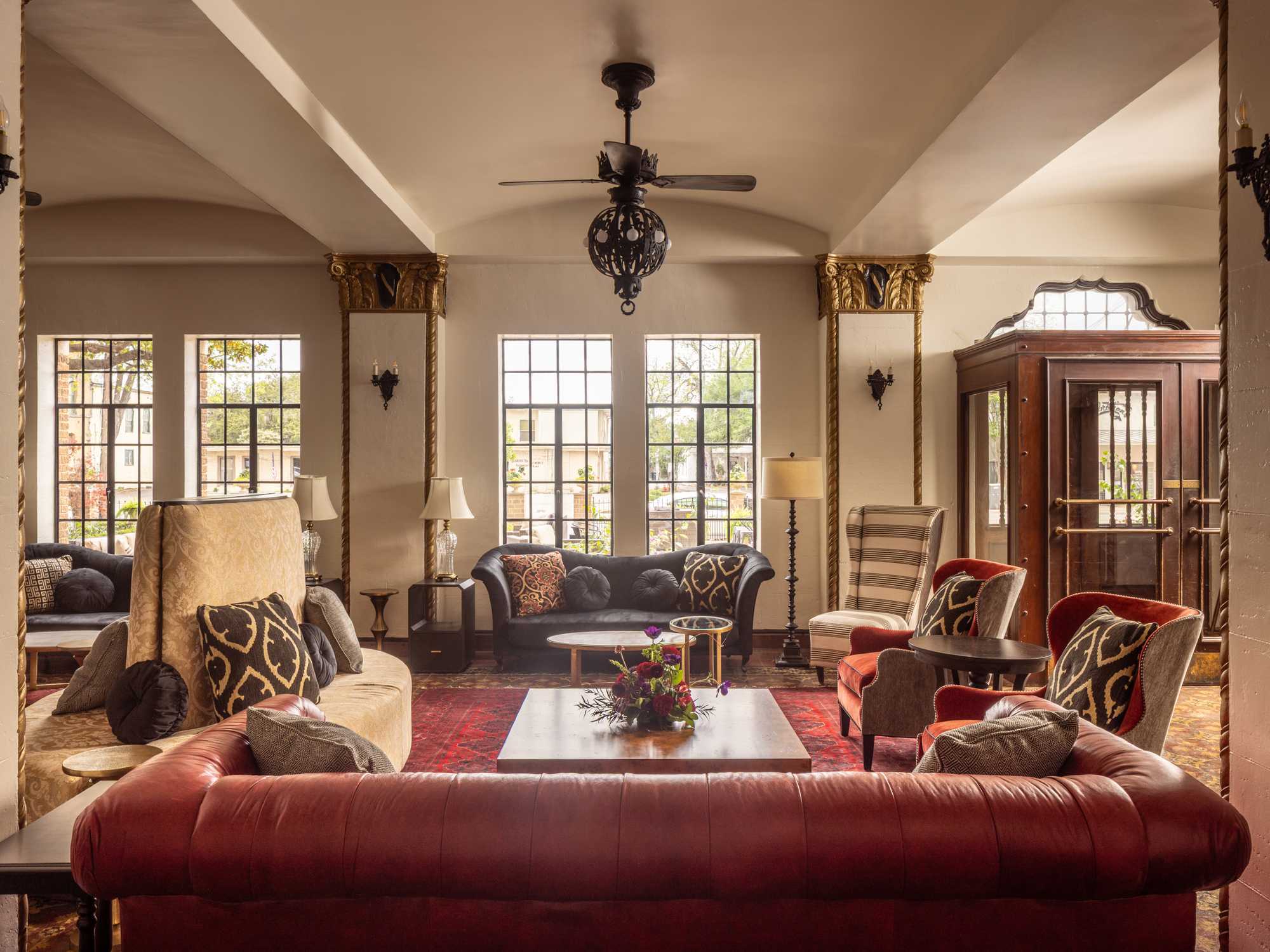 The revamped Faust Hotel blends the property's historic bones with new furnishings. Photo by Jason Risner
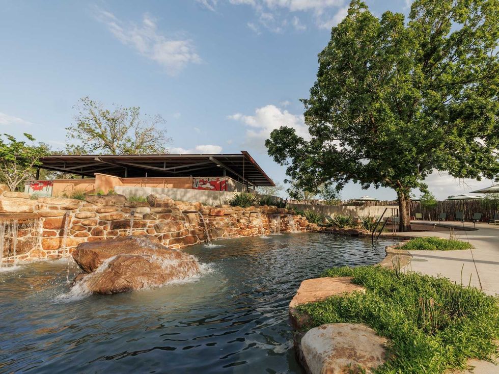
A Gonzales County wellness retreat is celebrating its one-year anniversary with a roster of new services, events, workshops, and more to come later this year. Ottine Mineral Springs is now offering private Watsu experiences, a massage performed in the mineral pools by licensed therapists before the general public arrives. The oasis will soon offer poolside cabana rentals, and open a climate-controlled indoor lounge and soaking space. Guests can book day passes (starting at $65), events, and spa services online. Reservations are required.
Limestone Fields, a new farm retreat on Lake Limestone in Jewett, is now accepting reservations for stays on its 16-acre property that sits along Lake Limestone. Guests are welcome to explore the expansive area, which also includes a working farm with chickens, ducks, and two Scottish Highland cows. Limestone Fields hosts 10 furnished cabins with front decks that overlook a pond and back decks that open to the lake. Stays start at $200 a night and usually have a two-night minimum. Prices vary with seasonality.
 Maisie is a miniature Highland cow that lives on the farm.Photo by Ashley Estave
Texas trade organization Texas Hill Country Wineries is offering a new way to experience its participating wineries' vintages with a new Barrels & Bites weekend event pass running from June 12-14. During the weekend, passholders can visit up to four wineries each day for winemaker-led experiences including elevated tastings or curated food and wine pairings. New this year is the Grand Tasting event at Ron Yates in Johnson City on Friday night from 5-7 pm, where passholders and single-ticket holders can try samples from 21 different wineries. Individual passes are $175, couples passes are $300, and single tickets for the Grand Tasting are $35 per person.
Austin
Adventurers can take their barbecue-loving dads for a smoke-filled weekend at Omni Barton Creek Resort & Spa in Austin for Father's Day weekend from June 19-20. The resort will host its second annual barbecue festival, Smoke: A Celebration of Fire and Flavor, bringing together the most prolific pitmasters and acclaimed restaurants for two days of live-fire cooking and live entertainment. The weekend kicks off with a VIP dinner experience on Friday featuring a multicourse meal of elevated barbecue dishes from chefs, and the barbecue showdown will commence Saturday with an open-air tasting event, live music, and a fireworks finale. Weekend bundle passes are $479 per person, with single admission tickets available for each day of the festival.
San Antonio
Magik Theatre, a beloved San Antonio children's performing arts center, is getting ready to for its grand reopening after months of renovations with a celebration party and a performance of The Very Hungry Caterpillar starting Saturday, June 13. The reopening party will feature a ribbon-cutting at Hemisfair Park, plus children's activities, a live DJ, and more. The Party in the Park is free to the public. Tickets for The Very Hungry Caterpillar, which will run until August 2, range from $26.50-$33.50 per person.
On the Gulf Coast
Galveston's seaside refuge Hotel Lucine is hosting the third annual Bludorn by The Sea dining series from June 12-13. Acclaimed Houston chef Aaron Bludorn will stage a two-night takeover of the hotel's on-site restaurant, The Fancy, with a raw bar pop-up from 4-7 pm, and elaborate four-course dinners planned each night. A Courtyard Party will precede Saturday's dinner from 12-3 pm with a yakitori-style grill-out and live music. Dinner reservations for Friday and Saturday ($95 per person) can be booked via OpenTable, and visitors are encouraged to book a stay at the hotel for the weekend.
Dallas-Fort Worth
June brings the arrival of World Cup season, and one Dallas-Fort Worth hotel is making its debut just in time to welcome FIFA fans from all over the world. The retro Caravan Court Hotel in Arlington will open at 205 N. Collins St. on June 1, less than a mile away from AT&T Stadium. The hotel offers 143 luxuriously appointed guest rooms, an in-house restaurant, martini bar, and a rooftop lounge. Room rates begin at $109 per night in June.
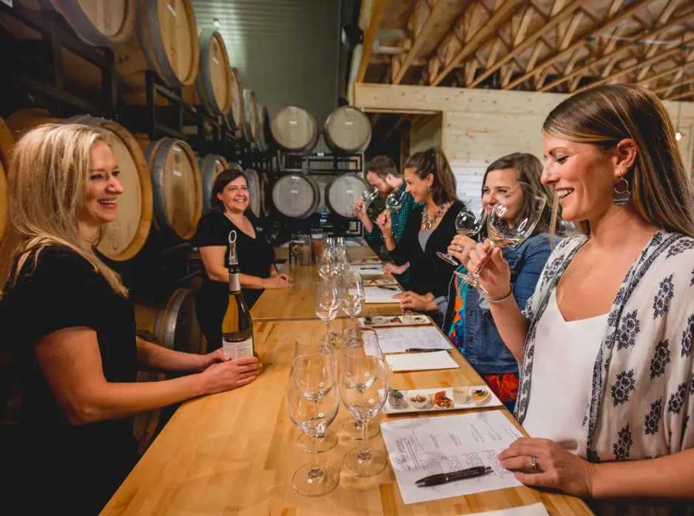
Photo courtesy of Texas Hill Country Wineries
The Barrels & Bites pass offers Hill Country wine lovers upscale tasting experiences or curated food and wine pairings.


Hotel Vin in Grapevine has launched a new "Route 66 Pit Stop" package in celebration of the iconic roadway's 100th anniversary. The package includes an Americana snack basket, Texas wine flight, disposable camera for capturing the journey, and grab-and-go breakfast for the road. Guests can also visit “The Vin Pit Stop" Lounge at WineYard Grille + Bar, the hotel's al fresco dining concept, for light bites, road trip-inspired specialty cocktail flights and Texas wine. Nightly rates for the "Route 66 Pit Stop" package start at $419.
Loading...