 There are many hotsprings along the river. By paddling away from the roads, itis possible to enjoy them in solitude. The small circle of stones (shown in thephoto) traps some of the warm mineral water bubbling out of a spring.Photo by Stephan Lorenz
 The dramatic entrance to Mariscal Canyon appears suddenly from the upstream end.It is the remotest of the three large canyons carved by the Rio Grande withinBig Bend National Park.Photo by Stephan Lorenz
 It is easy to find beautiful campsites along the river. Just drag the boat ontoland and set up.Photo by Stephan Lorenz
 The seasons can be extreme on the river, with summers unbearably hot, andwinters bitterly cold. The best seasons to float the river are spring and fall,with spring often having lower water levels than fall.Photo by Stephan Lorenz
 The sheer limestone cliffs reach 1,200 feet within Mariscal Canyon, making itonly accessible by boat.Photo by Stephan Lorenz
 Life along the river moves at a different pace. Seasonal monsoons carrynutrients and moisture to the floodplains, supporting relatively lushvegetation, including groves of cottonwood, mesquite, and many wild flowers.Photo by Stephan Lorenz
 Fern Canyon, within Santa Elena Canyon, is a must visit. Here, a slot canyonwinds away from the river on the Mexican side and includes waterfalls and manytenajas (featured toward the front of the photo).Photo by Stephan Lorenz
 Away from the canyons the river flows slow and broad, offering spectacularvistas in all directions. Due to the river’s meandering cours,e each mile treatsone to a new view.Photo by Stephan Lorenz
 Santa Elena Canyon offers relatively easy access to one of the river’s mostspectacular gorges. Just a few miles of upstream paddling will get you rightinto the heart of the canyon.Photo by Stephan Lorenz
 Here we have moonrise over the Sierra del Carmen in Mexico. These mountains arepart of a large biosphere and harbor many large animals, including black bears,which, in recent years have re-colonized Big Bend National Park.Photo by Stephan Lorenz
 Tenajas are cistern-like pools, often within canyons. This one is in FernCanyon. Besides summer, the water is often freezing cold.Photo by Stephan Lorenz
 The river supports dense vegetation within the desert, along with many animalsnot usually found in the otherwise dry climate.Photo by Stephan Lorenz
WASHINGTON (AP) — A historic South Texas mission joins the Stonewall National Monument, the President's House Site, and the Women's Rights National Historic Park among 11 sites on this year's annual list of the most endangered historic places in the United States compiled by the National Trust for Historic Preservation.
The 2026 list, announced Wednesday, May 20, marks America's 250th anniversary with the foundational principle that everyone is created equal as the theme, said Carol Quillen, president and CEO of the nonprofit organization. The 11 sites offer examples of how, over time, Americans have fought against injustice and for equality, she said.
“We wanted to think about those ideas, especially this notion that all human beings are created equal and find places, sometimes unsung places ... that not all Americans routinely think about," Quillen told The Associated Press.
The sites are spread across the United States — from New York and California on the East and West Coasts, to Alabama and Texas in the South, to Michigan in the Midwest and the Four Corners of Arizona, Colorado, New Mexico and Utah in the Rocky Mountain West.
At least three of the sites — Stonewall, the El Corazon church in Texas, and President's House in Philadelphia — have been endangered by Trump administration actions.
“We want to save these places," Quillen said, “not just because the bricks and mortar is important but because the stories these places hold are important."
For the first time since the list debuted in 1988, each site on the 2026 list will receive a one-time $25,000 grant to help highlight their connections to the principle that all people are created equal and address the threats they face.
The 11 sites are:
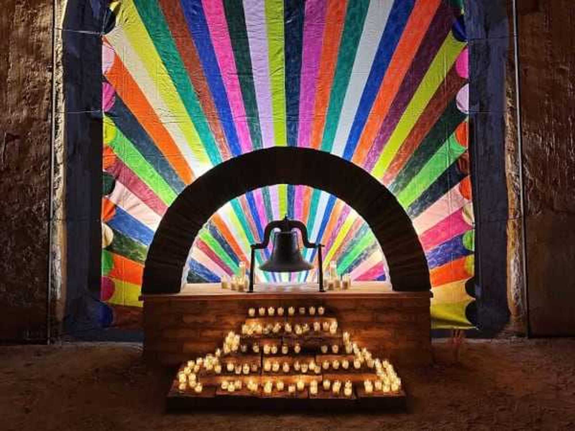
Ruidosa, Texas: El Corazon Sagrado de la Iglesia de Jesus
The more than century-old adobe church served as a refuge and place of worship for Mexican and Mexican American farming communities on both sides of the U.S.-Mexico border along the Rio Grande River. Vacant since the 1950s, the structure has benefited from continued restoration provided by the nonprofit Friends of the Ruidosa Church but remains threatened by proposed construction of a U.S. border wall that could come within a few hundred yards of the property. (The nonprofit has posted an official statement and more information about the border wall here.) Ruidosa is in far west Texas, roughly 35 miles northwest of Presidio and 46 miles southwest of Marfa, near the rugged Chinati Mountains.
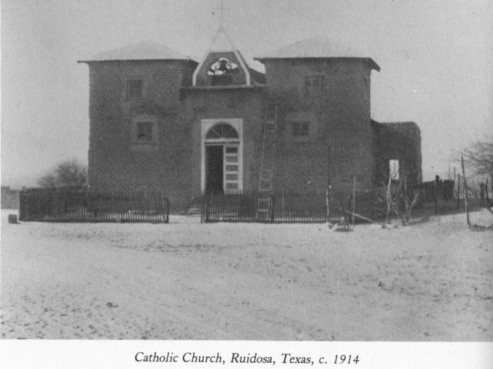 A historic photograph of El Corazon Sagrado de la Iglesia de Jesus.Facebook/Friends of the Ruidosa Church
Montgomery, Alabama: Ben Moore Hotel
The hotel was a refuge for Black people living under laws that enforced racial separation in the South. Prolonged vacancy has caused structural deterioration and the historic Centennial Hill neighborhood surrounding it faces pressure from development. The hotel housed key players from the Civil Rights Movement, including the Rev. Martin Luther King, Jr. and Rev. Ralph Abernathy. The Conservation Fund announced in November that it would help preserve the hotel.
Modoc County, California: Tule Lake Segregation Center
Initially known as the Tule Lake War Relocation Center, it was set up as a camp but later became a segregation center where Japanese Americans who were thought to be disloyal to the United States were imprisoned. The site is now a national monument managed by the National Park Service. Only 37 acres of the 1,100-acre site is protected. Most of it is at risk of permanent alteration from a proposed nearby construction project.
California: Angel Island Immigration Station
It was the largest immigration port on the West Coast between 1910 and 1940, particularly for immigrants from Asia and the Pacific. Hundreds of thousands were processed, detained and/or interrogated there because of their race. The station currently is threatened by physical, environmental, political and economic factors. Additional funding is needed for structural repairs and programming to increase awareness.
Somerset, Massachusetts: Swansea Friends Meeting House
Recognized as the oldest surviving Quaker meeting house in the state, it was built in 1701 to serve as a refuge by a congregation fleeing religious persecution and looking for a safe place to worship. The building has been closed for years and needs significant rehabilitation.
Michigan: Detroit Association of Women's Clubs
Founded in 1921, the association was one of the first Black organizations in Detroit to own their headquarters building, which was purchased in 1941. But the building has been closed since 2024, when water pipes burst and damaged the interior. Money is needed to help the association reopen the building.
New Mexico, Colorado, Arizona, Utah: Greater Chaco Cultural Landscape
The landscape is an ancestral homeland sustained for over a millennium by the Pueblo and Hopi people, but is threatened by changes to federal land policy that could open up significant portions to oil and gas development. Permanent protections and tribal consultation are needed to protect its cultural integrity.
Seneca Falls, New York: Women's Rights National Historical Park
The park tells the story of the first Women's Rights Convention, held in Seneca Falls, in July 1848. It faces a deferred maintenance backlog of over $10 million. Additional funding and support are needed to help preserve the park as a place to teach visitors about the history of women's rights.
New York: Stonewall National Monument
The first and only U.S. national monument dedicated to LGBTQ+ history was the subject of administration actions that saw the rainbow Pride flag removed from its flagpole earlier this year before it was restored. The National Park Service had removed the flag in February, citing federal guidance that limited the agency to displaying only the American, Interior Department and POW/MIA flags. But the administration reversed course in April as it agreed to settle a lawsuit filed by advocacy and historic preservation groups that sought to block the flag's removal at the Manhattan site.
After Trump returned to office, he ended diversity, equity and inclusion initiatives, and many references to transgender people were excised from the Stonewall monument’s website and materials. The Republican administration similarly has put national parks, museums and landmarks under a messaging microscope, aiming to remove or alter materials that it says are “divisive or partisan” or “inappropriately disparage Americans.”
Philadelphia: The President's House Site
The administration abruptly removed exhibits on the lives of nine people enslaved at the site in the 1790s under George Washington, the first U.S. president, who lived there when Philadelphia served as the nation's capital. The exhibits were taken down as part of a broad effort by the administration to remove from federal properties information it deems “disparaging” to Americans. The issue is currently the subject of litigation between the city and federal government.
Heath Springs, South Carolina: Hanging Rock Revolutionary War Battlefield
The Battle of Hanging Rock was a key battle in the Southern Campaigns of the Revolutionary War and is considered a Patriot victory that helped boost morale and ultimately weaken British control in South Carolina. Only portions of the core battlefield are protected and open to the public, with the area anticipating population growth and increasing development pressures.
Loading...